Top Menu

NASA logo
TAP

Archive | Active Missions RSS

S-MODE

S-MODE

Sub-Mesoscale Ocean Dynamics Experiment (S-MODE)


https://science.jpl.nasa.gov/projects/S-MODE/
https://espo.nasa.gov/s-mode

The Sub-Mesoscale Ocean Dynamics Experiment (S-MODE) is a NASA Earth Venture Suborbital-3 (EVS-3) mission. S-MODE will use measurements from a novel combination of platforms and instruments, along with data analysis and modeling, to test the hypothesis that submesoscale ocean dynamics make important contributions to vertical exchange of climate and biological variables in the upper ocean. This will require coordinated application of newly-developed in situ and remote sensing techniques, and it will provide an unprecedented view of the physics of submesoscale eddies and fronts and their effects on vertical transport in the upper ocean.

The Sub-Mesoscale Ocean Dynamics Experiment (S-MODE) is a NASA Earth Venture Suborbital-3 (EVS-3) mission. S-MODE will use measurements from a novel combination of platforms and instruments, along with data analysis and modeling, to test the hypothesis that submesoscale ocean dynamics make important contributions to vertical exchange of climate and biological variables in the upper ocean. This will require coordinated application of newly-developed in situ and remote sensing techniques, and it will provide an unprecedented view of the physics of submesoscale eddies and fronts and their effects on vertical transport in the upper ocean.

TEMPO

TEMPO

Tropospheric Emissions: Monitoring of Pollution (TEMPO)


The TEMPO (Tropospheric Emissions: Monitoring Pollution) mission aims to answer this question with more detail and precision than ever before, by creating a revolutionary new dataset of atmospheric chemistry measurements from space. TEMPO will be the first space-based instrument to monitor major air pollutants across the North American continent every daylight hour at high spatial resolution.

The TEMPO (Tropospheric Emissions: Monitoring Pollution) mission aims to answer this question with more detail and precision than ever before, by creating a revolutionary new dataset of atmospheric chemistry measurements from space. TEMPO will be the first space-based instrument to monitor major air pollutants across the North American continent every daylight hour at high spatial resolution.

TROPICS

TROPICS

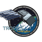
Time-Resolved Observations of Precipitation structure and storm Intensity with a Constellation of Smallsats (TROPICS)

Storm trackers observing inside dangerous tropical cyclones to identify storm intensity and structure

https://tropics.ll.mit.edu/CMS/tropics/Mission-Overview

https://disasters.nasa.gov/programs/tropics

NASA TROPICS blog

Imagine if you could peer inside a powerful tropical cyclone (TC). NASA’s TROPICS does and it aims to save lives in the process.

Tropical cyclones have been a source of some of the most devastating natural disasters, claiming countless lives, accounting for more than half of U.S. billion-dollar natural disaster damage events (https://www.ncdc.noaa.gov/billions/summary-stats), and disrupting society. A rise in global temperatures is expected to ramp up storm intensity and rainfall. NASA’s Time Resolved Observations of Precipitation structure and storm Intensity with a Constellation of Smallsats (TROPICS) is expected to launch in 2022 and will address science objectives that will ultimately improve our ability to accurately predict storm strength, giving people more time to evacuate and avoid loss of life. TROPICS is on a mission to find out how TCs form and intensify by measuring 3D temperature, humidity, cloud ice, and precipitation. This mission is critical because close to 60 million people, nearly 1/5 of Americans, live along the East and Gulf coasts. Recent years have seen major landfalling TCs along Atlantic coasts such as Irma, Maria, Michael, and Dorian that can cause significant death and destruction; damage projections suggest a doubling of US economic losses from TCs every ten years!

“TROPICS will observe deep inside cyclones, so we can forecast storms better, improve disaster preparation and ultimately save lives.” -William Blackwell, Principal Investigator, TROPICS

TROPICS provides high‐resolution, rapid updates on storm intensity, size, and precipitation structure. The science team will analyze observations of temperature, moisture, and precipitation at spatial resolutions ranging from approximately 15 kilometers to several hundred kilometers across the sky. Better storm prediction over all ocean basins is provided by six small satellites called CubeSats. They fly in three separate low-Earth orbital planes. Each CubeSat hosts a high‐performance sensor measuring water vapor absorption and precipitation‐sized ice particles. These instruments allow the team to view inside the core of a TC, with high resolution from different angles. The power of this knowledge about how TCs form, how they are maintained, and what makes some more intense than others, will lead to smarter storm predictions and better storm preparation by local authorities and residents.

Related Projects

MIT Lincoln Laboratory, Lunar Laser Communications Demonstration (LLCD); Laser Enhanced Mission Communications Navigation and Operational Services (LEMNOS); Deep Space Optical Comm (DSOC) Psyche Discovery Mission; Transiting Exoplanet Survey Satellite (TESS)
NASA Earth Science Technology Office. MicroMAS, CubeSat in 2018.

Tropical cyclones have been a source of some of the most devastating natural disasters, claiming countless lives, accounting for more than half of U.S. billion-dollar natural disaster damage events (https://www.ncdc.noaa.gov/billions/summary-stats), and disrupting society.  A rise in global temperatures is expected to ramp up storm intensity and rainfall. NASA’s Time Resolved Observations of Precipitation structure and storm Intensity with a Constellation of Smallsats (TROPICS) is expected to launch in 2022 and will address science objectives that will ultimately improve our ability to accurately predict storm strength, giving people more time to evacuate and avoid loss of life.  TROPICS is on a mission to find out how TCs form and intensify by measuring 3D temperature, humidity, cloud ice, and precipitation. This mission is critical because close to 60 million people, nearly 1/5 of Americans, live along the East and Gulf coasts. Recent years have seen major landfalling TCs along Atlantic coasts such as Irma, Maria, Michael, and Dorian that can cause significant death and destruction; damage projections suggest a doubling of US economic losses from TCs every ten years!

Powered by WordPress. Designed by WooThemes