

In the Mediterranean, it’s called “Sirocco,” and in the Canary Islands, “La Calima,” while it goes by “Harmattan” in West Africa, and “Haboob” in Sudan. But these varied names all describe the same thing: dust storms.
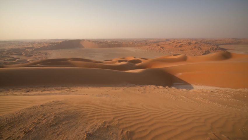
Sand and dust storms are a global phenomenon. These fine dust particles can be carried by winds across thousands of miles, impacting health and livelihoods.
According to the UN, dust storms have dramatically increased in recent years due to climate change, land degradation and drought.
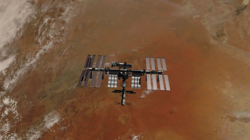
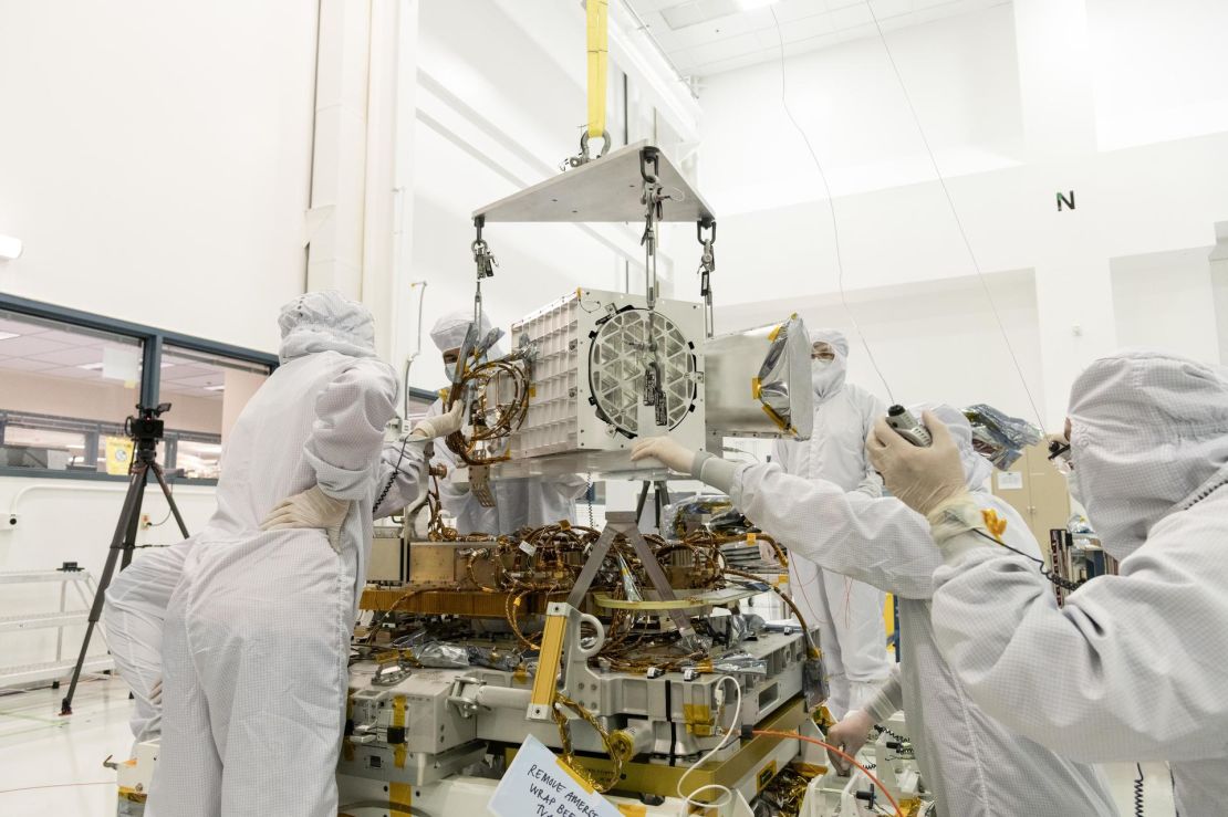
Climate scientist Natalie Mahowald hopes that by learning more about dust storms, we can plan for the future. An engineering professor at Cornell University in the US, she’s spent the last two decades tracking dust across the globe – and now, is working with NASA on a new instrument called EMIT.
The first-of-its-kind, space-borne imaging spectrometer is helping to map dust colors. Scientists can use the data in their climate models to work out how different minerals heat or cool the planet, explains Mahowald. Each type of dust has its own unique light-reflecting signature: for example, white dust reflects solar radiation, or heat, while “red and the dark dust absorbs it,” she says.
EMIT (the Earth Surface Mineral Dust Source Investigation) will “revolutionize what we can do,” says Mahowald. “We can use that (data) to better understand what the impact of desert dust is.”
A mineral map
Launched in July 2022, EMIT is attached to the International Space Station and orbits the Earth 16 times a day, mapping the mineral composition of the planet’s surface by gathering data on spectra, the different light wavelengths that are emitted by different colors.
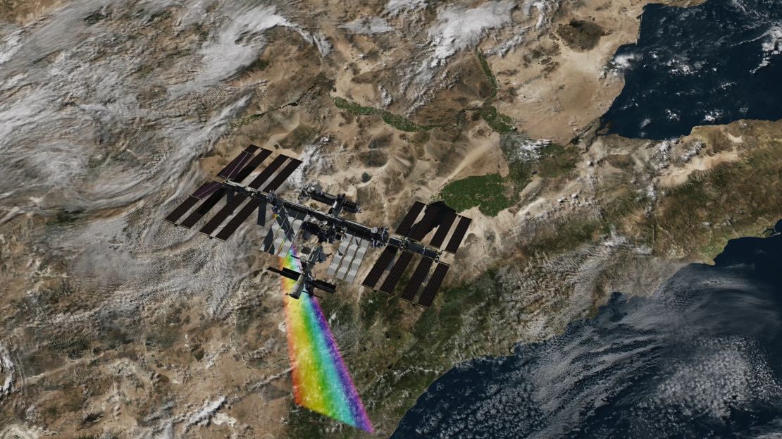
This information allows researchers to determine the mineral and chemical composition of substances on the surface. Scanning 50-mile-wide strips in a matter of seconds, the gadget will provide scientists with billions of data points to use in climate model predictions – greatly expanding the current data set which comes from just 5,000 sampling sites, says Mahowald.
Most of the existing data comes from agricultural land, where detailed soil information was valuable for farming and commercial purposes. The wealth of information provided by EMIT, which includes data from the world’s most arid regions, will help scientists learn much more about dust and its impact on climate – an issue which Mahowald says has been largely overlooked until now.
A vicious cycle
The UN estimates that 2,000 million tons of sand and dust are emitted into the atmosphere annually.
Sand and dust storms are vital for the planet, carrying nutritious soils across countries and continents and helping plant life to flourish – for example, dust from the Sahara Desert feeds trees in the Amazon rainforest, where the soil lacks the necessary nutrients.
“Ecosystems actually rely on dust aerosols,” says Diana Francis, a climate scientist at Khalifa University in Abu Dhabi.
But if dust storms become more frequent and intense, they could accelerate global warming: a report from the UN highlights how changing storm patterns could alter the distribution of Earth’s minerals and reduce rainfall, while dust aerosols can act like greenhouse gases in the atmosphere by absorbing solar radiation.
This could create a feedback loop, in which climate change causes more extreme dust storms through land degradation and drought, and dust storms exacerbate climate change. There’s evidence this is already happening, says Francis, pointing to “Godzilla,” the biggest dust storm worldwide in 20 years, which crossed the Atlantic in June 2020, darkening skies from the Caribbean to the US state of Texas.
Dust storms can cause respiratory illnesses, damage livestock and crops, and disrupt transport. In the Middle East and North Africa region, they are estimated to cost the economy $13 billion a year.
And the number and severity of storms in the Sahara Desert is on the rise, says Francis. In some of her earlier research, she found that dust from the Sahara had reached the Arctic, due to changes in atmospheric circulation.
“We noticed that during the last two decades, the darkening of the ice in the Arctic was becoming significant,” says Francis, highlighting another feedback loop. “We know that when the ice is dark it’ll reflect less of the solar light, and therefore it’ll melt faster.”
More than just dust
EMIT has delivered 5,000 data sets so far – each containing over 1.4 million spectra. Scientists at NASA are using the data to help map dust and soil composition across the globe.
But EMIT’s data is also being used to map another factor affecting climate change: methane.
Although it makes up just a fraction of greenhouse gas emissions, methane is estimated to have 80 times more warming power than carbon dioxide over the first 20 years after it enters the atmosphere.
Methane absorbs infrared light in a unique pattern, providing a “spectral fingerprint” that EMIT’s imaging spectrometer can pinpoint precisely. While NASA knew that EMIT’s imaging technology would be able to spot greenhouse gas emissions, it’s performing “better than expected,” says Robert Green, senior research scientist at NASA’s Jet Propulsion Laboratory and the principal investigator on the EMIT mission.
So far, EMIT has spotted 50 “super-emitters” across the world, mostly coming from fossil fuel, waste and agricultural facilities, in locations including the US, Iran and Turkmenistan.
While carbon dioxide lingers in the atmosphere for centuries, methane dissipates after a decade, which means that reducing methane emissions is a fast route to slowing climate change. NASA hopes that this information will encourage countries to stem their methane emissions.
While EMIT’s mission was initially scheduled to last just 12 months, Green says that there are now plans to extend the project.
Mahowald is excited for the future. “The EMIT project is testing the waters, and really showing what is possible,” she says. “We’re going to go from 5,000 to billions of pieces of data, and much higher resolution. That’s going to help us tremendously.”