Top Menu

NASA logo
TAP

NASA’s ECOSTRESS Mission Sees Plants ‘Waking Up’ From Space

PIA23430-16

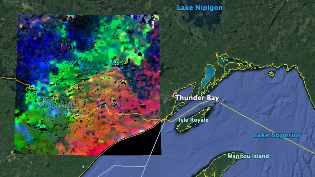
The image shows plants “waking up” near Lake Superior. Red areas began to wake up at around 7 a.m. local time; green areas awoke around 8 a.m.; and blue areas, at about 9 a.m. The data was acquired by ECOSTRESS during the summer season. Credits: NASA JPL

Like many people, plants are less active at night. The agency’s ‘space botanist’ can see when they begin to stir, and start their day.

Although plants don’t sleep in the same way humans do, they have circadian rhythms – internal clocks that, like our own internal clocks, tell them when it’s night and when it’s day. And like many people, plants are less active at night. When the Sun comes up, they kick into gear, absorbing sunlight to convert carbon dioxide they draw from the air and water they draw from the soil into food, a process called photosynthesis. They also “sweat” excess water through pores on their leaves to cool themselves down, a process called evapotranspiration.

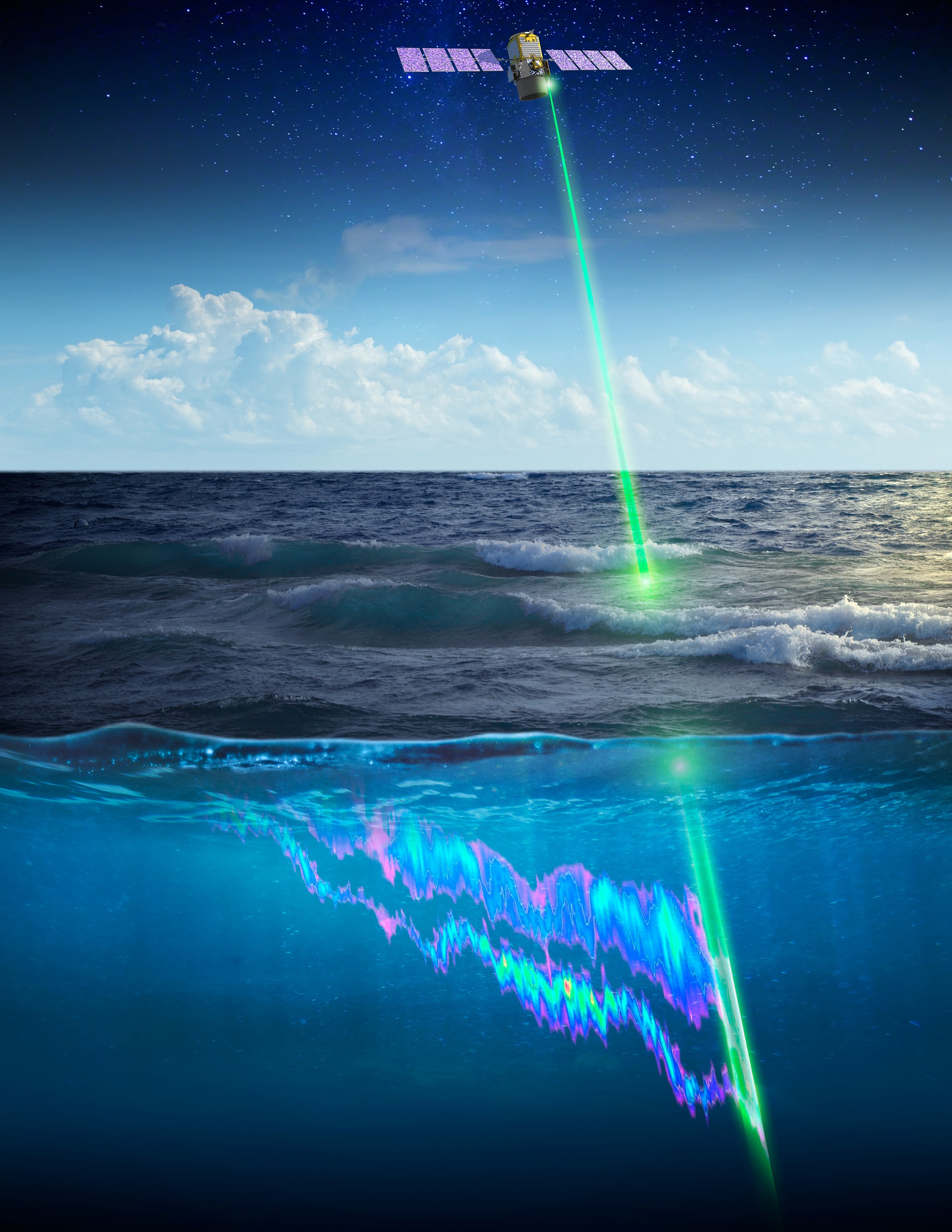
NASA’s ECOsystem Spaceborne Thermal Radiometer on Space Station (ECOSTRESS) can see when plants “wake up” and begin these processes from space. The image above shows plants waking up (as evidenced by evapotranspiration) west of Lake Superior near the U.S.-Canada border. Plants in the red and pink areas began to awake at around 7 a.m. local time. Those in green areas awoke closer to 8 a.m., and those in blue areas, closer to 9 a.m.

ECOSTRESS launched to the International Space Station in June 2018. The space station’s unique orbit enables the instrument to capture data over the same areas at different times of day. When the mission team analyzes the data, they gain new insight into how plants behave throughout the course of a day.

For this image, the mission team collected and combined all of ECOSTRESS’s morning data for the summer season. In doing so, they observed that the earliest risers were near the lake, with plant activity spreading gradually northwestward as the morning progressed.

ECOSTRESS’ ability to detect plant behavior in this way can be especially helpful to resource managers and farmers, who can use the data to determine how much water their crops need, which ones are most water-efficient and which ones aren’t getting enough water, even before they show visible signs of dehydration. What’s more, the instrument can provide this data on a global scale over areas as small as a football field.

NASA’s Jet Propulsion Laboratory in Pasadena, California, built and manages the ECOSTRESS mission for the Earth Science Division in the Science Mission Directorate at NASA Headquarters in Washington. ECOSTRESS is an Earth Venture Instrument mission; the program is managed by NASA’s Earth System Science Pathfinder program at NASA’s Langley Research Center in Hampton, Virginia.

More information about ECOSTRESS is available here:

https://ecostress.jpl.nasa.gov

News Media Contact

Rexana Vizza
Jet Propulsion Laboratory, Pasadena, Calif.
818-354-8307
Rexana.v.vizza@jpl.nasa.gov

Written by Esprit Smith, NASA’s Earth Science News team

2020-023

Continue Reading

NASA, French Space Laser Measures Massive Migration of Ocean Animals

RELEASE 19-091

Researchers used the space-based CALIPSO lidar to measure the planet’s largest animal migration, which takes place when small sea creatures swim up from the depths at night to feed on phytoplankton, then back down again just before sunrise. Credits: NASA/Timothy Marvel

Researchers used the space-based CALIPSO lidar to measure the planet’s largest animal migration, which takes place when small sea creatures swim up from the depths at night to feed on phytoplankton, then back down again just before sunrise.
Credits: NASA/Timothy Marvel

Tiny creatures such as small squid, fish and krill are part of the massive vertical migration pattern in the ocean that has now been measured around the world from space. Credits: Chandler Countryman

Tiny creatures such as small squid, fish and krill are part of the massive vertical migration pattern in the ocean that has now been measured around the world from space.
Credits: Chandler Countryman

Every night, under the cover of darkness, countless small sea creatures – from squid to krill – swim from the ocean depths to near the surface to feed. This vast animal migration – the largest on the planet and a critical part of Earth’s climate system – has been observed globally for the first time thanks to an unexpected use of a space-based laser.

Researchers observed this vertical migration pattern using the Cloud-Aerosol Lidar and Infrared Pathfinder Satellite Observations (CALIPSO) satellite — a joint venture between NASA and the French space agency, Centre National d’Etudes Spatiales — that launched in 2006. They published their findings in the journal Nature Wednesday.

“This is the latest study to demonstrate something that came as a surprise to many: that lidars have the sensitivity to provide scientifically useful ocean measurements from space,” said Chris Hostetler, a scientist at NASA’s Langley Research Center in Hampton, Virginia, and co-author on the study. “I think we are just scratching the surface of exciting new ocean science that can be accomplished with lidar.”

The study looks at a phenomenon known as Diel Vertical Migration (DVM), in which small sea creatures swim up from the deep ocean at night to feed on phytoplankton near the surface, then return to the depths just before sunrise. Scientists recognize this natural daily movement around the world as the largest migration of animals on Earth in terms of total number.

The cumulative effect of daily vertically migrating creatures on Earth’s climate is significant. During the day, ocean phytoplankton photosynthesize and, in the process, absorb significant amounts of carbon dioxide, which contributes to the ocean’s ability to absorb the greenhouse gas from the atmosphere. Animals that undergo DVM come up to the surface to feed on phytoplankton near the ocean’s surface and then swim back down, taking the phytoplankton carbon with them. Much of this carbon is then defecated at depths where it is effectively trapped deep in the ocean, preventing its release back into the atmosphere.

“What the lidar from space allowed us to do is sample these migrating animals on a global scale every 16 days for 10 years,” said Mike Behrenfeld, the lead for the study and a senior research scientist and professor at Oregon State University in Corvallis, Oregon. “We’ve never had anywhere near that kind of global coverage to allow us to look at the behavior, distribution and abundance of these animals.”

Zeroing in on tropical and subtropical ocean regions, researchers found that while there are fewer vertically migrating animals in lower-nutrient and clearer waters, they comprise a greater fraction of the total animal population in these regions. This is because the migration is a behavior that has evolved primarily to avoid visual predators during the day when visual predators have their greatest advantage in clear ocean regions.

In murkier and more nutrient-rich regions, the abundance of animals that undergo DMV is higher, but they represent a smaller fraction of the total animal population because visual predators are at a disadvantage. In these regions, many animals just stay near the surface both day and night.

The researchers also observed long-term changes in populations of migrating animals, likely driven by climate variations. During the study period (2008 to 2017), CALIPSO data revealed an increase in migrating animal biomass in the subtropical waters of the North and South Pacific, North Atlantic and South Indian oceans. In the tropical regions and North Atlantic, biomass decreased. In all but the tropical Atlantic regions, these changes correlated with changes in phytoplankton production.

This animal-mediated carbon conveyor belt is recognized as an important mechanism in Earth’s carbon cycle. Scientists are adding animals that undergo DVM as a key element in climate models.

“What these modelers haven’t had is a global dataset to calibrate these models with, to tell them where these migrators are most important, where they’re most abundant, and how they change over time,” said Behrenfeld. “The new satellite data give us an opportunity to combine satellite observations with the models and do a better job quantifying the impact of this enormous animal migration on Earth’s carbon cycle.”

The satellite data are also relevant to global fisheries because the migrating animals are an important food source for larger predators that lurk in the depths of the ocean. Those predators are often species of fish that are attractive to commercial fisheries. The larger the DVM signal, the larger the population of fish that can live in the deep sea.

Though CALIPSO’s laser was designed to measure clouds and atmospheric aerosols, it can penetrate the upper 20 meters of the ocean’s surface layer. If the migrating animals reach this layer, they are detected by CALIPSO.

NASA uses the vantage point of space to understand and explore our home planet, improve lives and safeguard our future. The agency’s observations of Earth’s complex natural environment are critical to understanding how our planet’s natural resources and climate are changing now and could change in the future.

For more information about NASA’s Earth science activities, visit:

-end-

Steve Cole
Headquarters, Washington
202-358-0918
stephen.e.cole@nasa.gov

Joe Atkinson
Langley Research Center, Hampton, Va.
757-864-5644
joseph.s.atkinson@nasa.gov

Continue Reading

Drought-Stressed Forest Fueled Amazon Fires

NASA's ECOSTRESS sensor measured the stress levels of plants when it passed over the Peruvian Amazon rainforest on Aug. 7, 2019. The map reveals that the fires were concentrated in areas of water-stressed plants (brown). The pattern points to how plant health can impact the spread of fires. Credits: NASA/JPL-Caltech/Earth Observatory

NASA’s ECOSTRESS sensor measured the stress levels of plants when it passed over the Peruvian Amazon rainforest on Aug. 7, 2019. The map reveals that the fires were concentrated in areas of water-stressed plants (brown). The pattern points to how plant health can impact the spread of fires.
Credits: NASA/JPL-Caltech/Earth Observatory

A new satellite-based map of a section of the Amazon Basin reveals that at least some of the massive fires burning there this past summer were concentrated in water-stressed areas of the rainforest. The stressed plants released measurably less water vapor into the air than unstressed plants; in other words, they were struggling to stay cool and conserve water, leaving them more vulnerable to the fires.

The fires in the Amazon Basin, which continue to burn into November, are mainly the result of such human activities as land clearing and deforestation. The pattern — spotted from space by NASA’s ECOsystem Spaceborne Thermal Radiometer Experiment on Space Station (ECOSTRESS) — points to how water-stressed plants can impact the spread of fires. The data may one day help NASA’s Earth-observing missions predict the path of future forest or brush fires like those currently raging in California.

The primary mission of ECOSTRESS, an instrument that measures thermal infrared energy emitted from the land surface, is to provide insight into plants’ health by taking their temperature. To keep cool, plants “sweat” by releasing water vapor through their pores, a process called evapotranspiration. After multiple orbits, ECOSTRESS is able to measure how much plants transpire and track their response to climate change.

In August, fires spread over large swaths of the Amazon Basin. ECOSTRESS captured the first image of the Amazon rainforest in Peru before the fires began, on Aug. 7. It shows a surface temperature map revealing water-stressed and non-stressed forest (shown in brown and blue, respectively). The fire icons represent fires imaged by NASA’s Terra satellite between Aug. 19 and 26. The fires are limited primarily to areas of water-stressed plants that transpired the least. The second image, taken by the Terra satellite on Aug. 18, shows the ECOSTRESS study area and smoke from active fires in the rainforest.

This satellite image, taken by NASA's Earth-observing Terra satellite on Aug. 18, 2019, shows the ECOSTRESS study area in the Amazon Basin and smoke from active fires in the rainforest. Credits: NASA/JPL-Caltech/Earth Observatory

This satellite image, taken by NASA’s Earth-observing Terra satellite on Aug. 18, 2019, shows the ECOSTRESS study area in the Amazon Basin and smoke from active fires in the rainforest.
Credits: NASA/JPL-Caltech/Earth Observatory

The image also reveals how certain parts of the forest were more resilient, seeming to protect themselves from burning. Plants in these areas were cooler — in other words, they released more water vapor from their leaves — than plants in the burn zones, though mission scientists don’t know whether that’s a coincidence or a direct causal relationship. The water-stressed areas of the forest look as green and healthy as these cooler areas, making them invisible except to a radiometer that can measure thermal infrared energy from the surface.

“To the naked eye, the fires appear randomly distributed throughout the forest,” said Josh Fisher, ECOSTRESS science lead at NASA’s Jet Propulsion Laboratory in Pasadena, California. “But, if you overlay the ECOSTRESS data, you can see that the fires are mainly confined within the highly water-stressed areas. The fires avoided the low-stress areas where the forest appears to have access to more water.”

It’s still a mystery why some plants become stressed while other plants don’t, though scientists believe it’s dependent on factors like the species of plant or amount of water in the soil. The data from ECOSTRESS will help answer questions about which plants will thrive in their changing environments and could also be used to help with decisions related to water management and agricultural irrigation.

JPL built and manages the ECOSTRESS mission for the Earth Science Division in the Science Mission Directorate at NASA Headquarters in Washington. ECOSTRESS is an Earth Venture Instrument mission; this program is managed by NASA’s Earth System Science Pathfinder program at NASA’s Langley Research Center in Hampton, Virginia.

More information about ECOSTRESS is available here:

Arielle Samuelson
Jet Propulsion Laboratory, Pasadena, Calif.
818-354-0307
arielle.a.samuelson@jpl.nasa.gov

2019-221

Continue Reading

Powered by WordPress. Designed by WooThemes