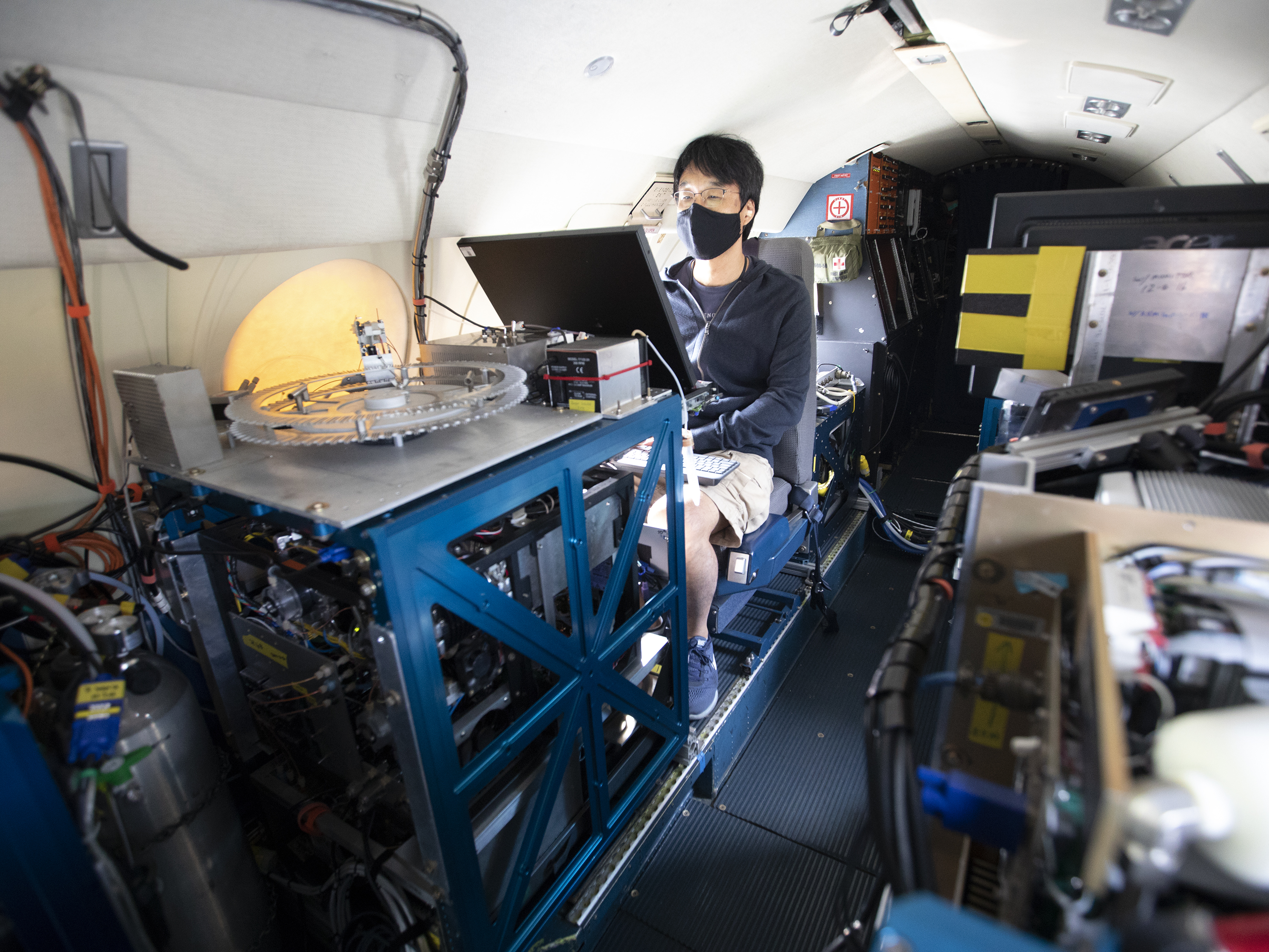
Masks are part of the safety protocol for ACTIVATE scientists. Here, Yonghoon Choi prepares for a science flight on the HU-25 Falcon.
Credits: NASA/David C. Bowman
Four months ago, with COVID-19 disrupting life across the globe, it seemed virtually unthinkable that a major NASA airborne science campaign would fly again anytime soon.
But today, that’s exactly what’s happening.
In August, NASA’s Aerosol Cloud Meteorology Interactions Over the Western Atlantic Experiment (ACTIVATE) eased into its second set of 2020 science flights out of NASA’s Langley Research Center in Hampton, Virginia. Barring any threats to the health or safety of the researchers or crew, flights will continue through the end of September.
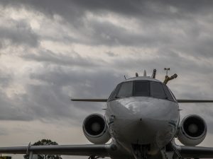
The HU-25 Falcon sits on the tarmac just ahead of a flight.
Credits: NASA/David C. Bowman
Those flights are taking scientists over the western Atlantic Ocean to study how atmospheric aerosols and meteorological processes affect cloud properties. In addition, modelers will use data from these flights to better characterize how the clouds themselves, in turn, affect aerosol particle properties and the amount of time they spend in the atmosphere, as well as the meteorological environment. Coordinated flights between a King Air and an HU-25 Falcon allow researchers to fly above, below and through the clouds with a suite of instruments that can take measurements remotely, or from the air around the aircraft.
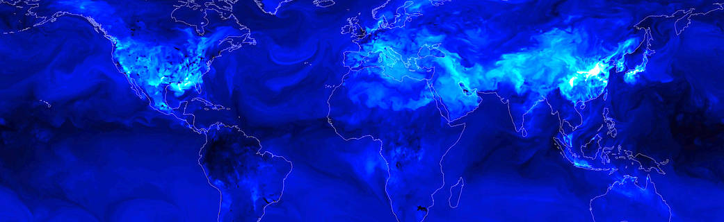
“The data have been really good so far,” Armin Sorooshian, ACTIVATE principal investigator and an atmospheric scientist at the University of Arizona, said of the summer flights. “We’ve seen some interesting features, like smoke from the wildfires on the West Coast.”
That smoke can seed clouds over the Atlantic Ocean.
Sorooshian is leading the campaign remotely from his home in Tucson, Arizona, where he and his wife are juggling work and the care of two children — a two-year-old boy and a baby girl who was born in July.
He admits it’s “a little tough.” But in a world where these flights could have been scrubbed from the calendar completely, Sorooshian isn’t interested in dwelling on the negatives.
“They’re good problems,” he said.
Good Problems
The ACTIVATE team began the first of two planned 2020 flight campaigns in February. They completed most of those flights, but had to pull the plug a little early in mid-March when concerns about the spread of COVID-19 began to sweep across the U.S. At that point, the fate of the second set of flights, originally scheduled for May and June, was — pardon the pun — very much up in the air.
As the COVID situation evolved, though, and as Langley leadership began to admit a limited number of research projects back on center with stringent safety protocols in place, it became clear there might be a glimmer of hope for ACTIVATE.
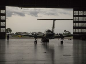
The King Air rolls out of the hangar before a science flight.
Credits: NASA/David C. Bowman
ACTIVATE is uniquely positioned among other current NASA airborne science missions because it’s based out of a NASA center, and the flight crew and many members of the science team are also based out of that center. John Hair, ACTIVATE project scientist with Langley’s Science Directorate, knew that from a purely logistical perspective, the mission could return to flight without the need for anyone to travel in from out of town.
“We had an opportunity because ACTIVATE has a relatively small crew that can operate the instruments in the aircraft, and do that, we felt, safely — albeit with some changes to the initial plans we set out,” he said.
Besides obvious stuff such as wearing masks and being mindful of social distancing, those changes include conducting the various daily flight planning meetings and pre-flight briefings completely via video conference. Researchers are also doing real-time monitoring of flight data from their homes. For researchers who are flying or need to be on center, the project has found ways to streamline some processes.
“For example, people are learning how to do their calibrations at the end of the flight after the instruments are already warmed up,” said Hair. “And then it only takes an hour to do.”
Compare that to the three or four hours it can take a researcher to warm up and calibrate an instrument before a flight.
The entire operation has taken a lot of careful planning and coordination between Langley’s Science Directorate, Research Services Directorate and Center Operations Directorate. Sheer determination has certainly played a role as well.
“We all signed up for supporting research as it comes in. ACTIVATE was in the middle of a major campaign and we wanted to get them back to flying as soon as we could,” said Taylor Thorson, ACTIVATE project pilot with Langley’s Research Services Directorate.
Sorooshian believes this experience could be instructive for the next round of flights, which are currently scheduled to kick off in February 2021 when COVID-19 could still be a significant concern.
It’s not just instructive from a safety perspective. Marine clouds are more scattered and difficult to forecast in the summer.
“Flying this summer also allows the team to hone the flight planning strategies, which can build upon heading into the next two years of flight campaigns,” he said.
For now, he and Hair are just happy to see a study they both care deeply about back in action.
“This is exciting that we’re out doing some flights,” said Hair. “People are excited to get the critical science data that we’re collecting on these flights.”
The ACTIVATE science team includes researchers from NASA, the National Institute of Aerospace, universities, Brookhaven National Laboratory, Pacific Northwest National Laboratory, the National Center for Atmospheric Research and the German Aerospace Center. The current flight campaign is the second of two in 2020, with two more to follow in 2021, and another two in 2022.
ACTIVATE is one of five new NASA Earth Venture campaigns originally scheduled to take to the field in 2020. Three of the five have been postponed due to COVID-19. To learn more about the other campaigns, visit: https://www.nasa.gov/feature/goddard/2019/nasa-embarks-on-us-cross-country-expeditions
NASA Langley Research Center
Read Full Article
*Source: NASA.gov