Top Menu

NASA logo
TAP

Tag Archives | Water

CYGNSS

Cyclone Global Navigation Satellite System (CYGNSS)

A new constellation in space is telling us how hurricanes and floods are threatening us on Earth

https://www.nasa.gov/cygnss

  On December 15, 2016, an aircraft called “Stargazer” took off from Cape Canaveral, Florida and flew a hundred miles or so off the coast. During flight, a rocket was launched from the aircraft carrying eight NASA micro-satellites into space called Cyclone Global Navigation Satellite System (CYGNSS). The CYGNSS microsatellites are currently orbiting the tropics about 315 miles up. CYGNSS is used to measure winds in tropical storms and hurricanes. Since it can “see” the winds inside the storms and at the surface of the ocean, CYGNSS is able to improve predictions of how strong hurricanes will get and where they will make landfall. Not only is CYGNSS looking at the ocean, it is also studying moisture levels in the land. These soil moisture measurements can improve predictions of soil saturation, rain runoff and flooding. This data helps keep people who live in coastal areas safe from hurricane disasters and helps them plan better communities to combat future storms.

“It is very gratifying to see the potential CYGNSS has to make useful, practical contributions to people’s everyday lives by improving forecasts of storms and floods.” – Chris Ruf, PI, CYGNSS

The technology on each of the CYGNSS microsatellites is something familiar – a GPS! When CYGNSS sends GPS radio signals to the earth and they are bounced off of ocean waves, the signal that is reflected back to the satellite tells us what the winds are like right at the ocean surface. Since it was launched in 2016, scientists have been learning how to use CYGNSS data in many other ways too. It is able to show us flooded areas on land – during Hurricane Harvey, CYGNSS was used to identify the spread of the flooding over the Houston area. This helps “first responders” know which areas need urgent help during flooding disasters. Recently, CYGNSS has been used to help locate areas of a major locust outbreak in East Africa. CYGNSS satellites may be micro-sized, but they have a huge role in helping us better understand hurricanes, flooding, and locusts.

The Cyclone Global Navigation Satellite System (CYGNSS) will probe the inner core of hurricanes to learn about their rapid intensification.

Delta-X

Delta-X

Delta-X – Forecasting the fate of the Mississippi River Delta

Mississippi Delta is in peril with the livelihood of millions in jeopardy
“Good Lord’s willing, and the creek don’t rise.” Johnny Cash

Simulate climate and predict change as it happens!

Deltas everywhere provide many benefits to life on earth – like serving as a natural protection for our cities and towns against storm surges and tsunamis, or being wetland habitats for crustaceans, mammals, and birds. Many deltas are home to large cities, and people depend on the wetlands for their livelihoods. Deltas around the world, however, are in peril! They’re drowning due to sea level rise and lack of sediment deposited by rivers; it is expected that nearly all of the world’s major river deltas are at risk of drowning this century. The natural influx of sediments from upstream would naturally build up the deltas and provide resilience to sea level rise, however, river channels delivering the sediments have been disrupted by human activities.

“We hope Delta-X calibrated hydrodynamic models will support other agencies and stakeholders in planning coastal
restoration projects and managing resources in the Mississippi River Delta.” – Marc Simard, Delta-X Principal Investigator

NASA’s Delta-X project seeks to understand how parts of the Mississippi River Delta (MRD) are growing and others are sinking. Due to a combination of factors (sea level rise; the disruption of sedimentation; a general sinking of the land due to natural compaction, underground extraction of oil, gas, and water), the Louisiana coastline has been losing land at the rate of almost one football field every hour during the last few decades! Delta-X scientists will collect data over the Atchafalaya and Terrebonne basins during two deployments in 2021 using state of the art remote sensing instruments onboard three aircraft and using in-situ (direct) instruments deployed across the basins. The Delta-X scientists will use this data to learn how and where the MRD is gaining and losing land. The data will be used to improve and calibrate models that predict how the MRD will respond to continuing sea level rise over the next century and to identify which areas are the most vulnerable to sea level rise and storms.

https://www.youtube.com/watch?v=I0oAkijxj-E#action=share
https://www.jpl.nasa.gov/news/news.php?feature=7601
https://www.youtube.com/watch?v=beeD3GRTkpQ

Deltas everywhere provide many benefits to life on earth – like serving as a natural protection for our cities and towns against storm surges and tsunamis, or being wetland habitats for crustaceans, mammals, and birds.


GLIMR

Geosynchronous Littoral Imaging and Monitoring Radiometer (GLIMR)

NASA has selected a space-based instrument under its Earth Venture Instrument (EVI) portfolio that will make observations of coastal waters to help protect ecosystem sustainability, improve resource management, and enhance economic activity.

The selected Geosynchronous Littoral Imaging and Monitoring Radiometer (GLIMR) instrument, led by principal investigator Joseph Salisbury at the University of New Hampshire, Durham, will provide unique observations of ocean biology, chemistry, and ecology in the Gulf of Mexico, portions of the southeastern United States coastline, and the Amazon River plume – where the waters of the Amazon River enter the Atlantic Ocean.

NASA has selected a space-based instrument under its Earth Venture Instrument (EVI) portfolio that will make observations of coastal waters to help protect ecosystem sustainability, improve resource management, and enhance economic activity.

GRACE

GRACE

Gravity Recovery and Climate Experiment (GRACE)


https://www.jpl.nasa.gov/missions/gravity-recovery-and-climate-experiment-grace/

An award-winning mission that’s changed the way we study Earth’s gravitational forces and the Earth system, the Gravity Recovery and Climate Experiment, or GRACE, mission flew twin spacecraft in tandem around Earth to study key changes in the planet’s waters, ice sheets and the solid Earth.

In 2011, the gravity measurement technique pioneered by GRACE, which works by measuring changes in the push and pull between the twin spacecraft as they orbit Earth, was put to use on NASA’s twin GRAIL spacecraft embarking on an ambitious mission to study the gravitational forces of Earth’s moon.

In more than 15 years of operations, the GRACE satellite mission revolutionized our view of how water moves and is stored on Earth.

An award-winning mission that’s changed the way we study Earth’s gravitational forces and the Earth system, the Gravity Recovery and Climate Experiment, or GRACE, mission flew twin spacecraft in tandem around Earth to study key changes in the planet’s waters, ice sheets and the solid Earth.


Oceans Melting Greenland (OMG)

Oceans Melting Greenland

https://twitter.com/omgnasa?lang=en

Probing melting glaciers from the sky, exploring the journey of ocean water

You see the tip of a melting iceberg; we see a plane, an ocean, a probe, and OMG… We jump inside!

NASA’s Oceans Melting Greenland (OMG) mission is right here on Earth and it’s showing us the precise role oceans are playing in melting glaciers. Some glaciers in Greenland have been around for a million years; however, in just the last few decades, they have begun disappearing due to climate change. Greenland’s glaciers are massive – if all of those glaciers were to melt, the sea level would rise 25ft; that could translate to Washington DC being under water in the future. (Check your home town or favorite beach here) The glaciers are being attacked from all sides, from the air above and now OMG is discovering, from warm water underneath. The sea floor around Greenland has channels that snake up into the continental shelf and the warm salty water rides right up onto the front of the glacier. Warmer water, means faster glacier melt and losing more of our precious coastline.

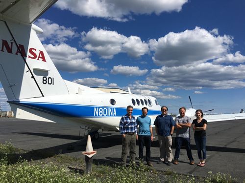
“Amazing flight today through the dramatic canyons beyond Scoresby Sound. Got the first data in front of Vestfjord Glacier, which was almost 600m deep. Dropped 26 probes (total 193) and got 23 good profiles. #omgnasa” – Josh Willis, OMG Principal Investigator

OMG uses two planes, a satellite, a ship and elusive narwhals measure how the glaciers and oceans change from year to year. Aircraft launch 250 big, grey cylinder probes into the ocean every summer, the only time there is open water and less ice around most of Greenland. As the probes sink to the ocean floor, they radio back temperature and salinity measurements from the surface to the sea floor back to the team. In addition, both the shape and depth of the sea floor (bathymetry) were measured by ships and airplanes. Whales become oceanographers, gathering temperature, salinity and dive depth data while they feed at glacier waters. This project is changing the way scientists think about the melting of Greenland’s glaciers from underneath! See how temperature has changed in 5 years and what is going to happen in the 6th year, 2021. Come ride along with a narwhal whale and a NASA radio transmitter to discover more.

Check out other Earth Pathfinder projects to see if this melting can be reversed and follow OMG on the tracker at https://airbornescience.nasa.gov/tracker/#!/status/map?callsign=C-GJKB

NASA’s Oceans Melting Greenland (OMG) mission is right here on Earth and it’s showing us the precise role oceans are playing in melting glaciers. Some glaciers in Greenland have been around for a million years; however, in just the last few decades, they have begun disappearing due to climate change. Greenland’s glaciers are massive – if all of those glaciers were to melt, the sea level would rise 25ft; that could translate to Washington DC being under water in the future.


S-MODE

S-MODE

Sub-Mesoscale Ocean Dynamics Experiment (S-MODE)


https://science.jpl.nasa.gov/projects/S-MODE/
https://espo.nasa.gov/s-mode

The Sub-Mesoscale Ocean Dynamics Experiment (S-MODE) is a NASA Earth Venture Suborbital-3 (EVS-3) mission. S-MODE will use measurements from a novel combination of platforms and instruments, along with data analysis and modeling, to test the hypothesis that submesoscale ocean dynamics make important contributions to vertical exchange of climate and biological variables in the upper ocean. This will require coordinated application of newly-developed in situ and remote sensing techniques, and it will provide an unprecedented view of the physics of submesoscale eddies and fronts and their effects on vertical transport in the upper ocean.

The Sub-Mesoscale Ocean Dynamics Experiment (S-MODE) is a NASA Earth Venture Suborbital-3 (EVS-3) mission. S-MODE will use measurements from a novel combination of platforms and instruments, along with data analysis and modeling, to test the hypothesis that submesoscale ocean dynamics make important contributions to vertical exchange of climate and biological variables in the upper ocean. This will require coordinated application of newly-developed in situ and remote sensing techniques, and it will provide an unprecedented view of the physics of submesoscale eddies and fronts and their effects on vertical transport in the upper ocean.

Powered by WordPress. Designed by WooThemes