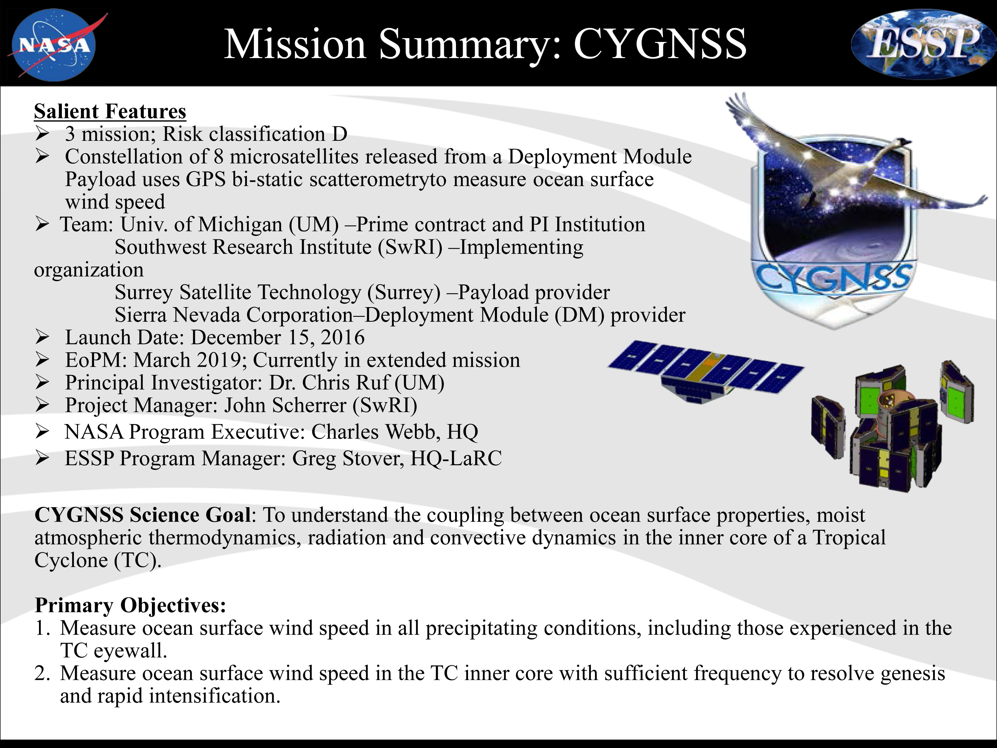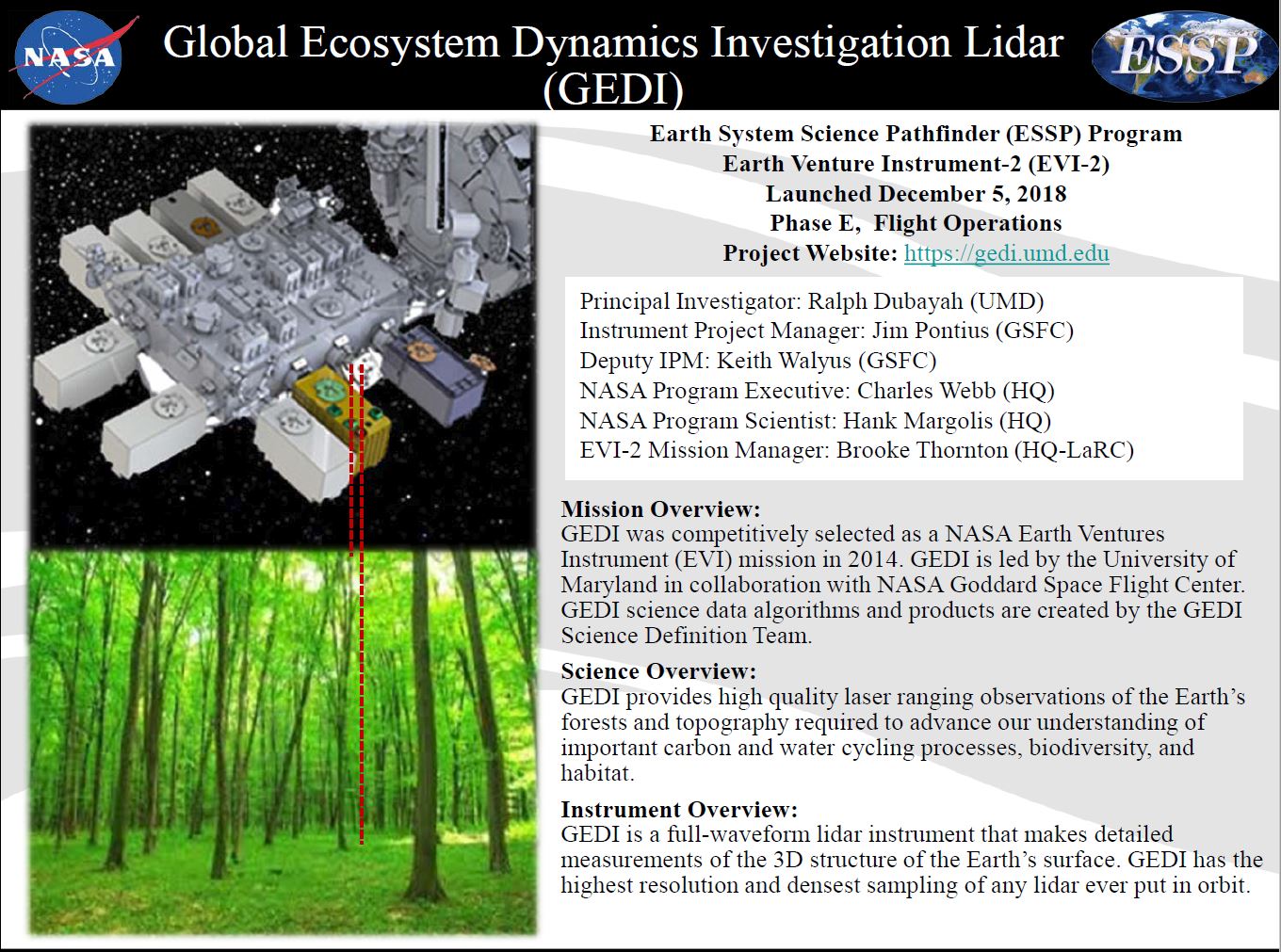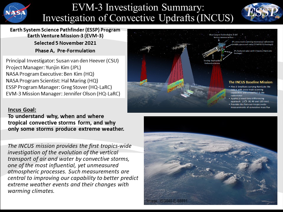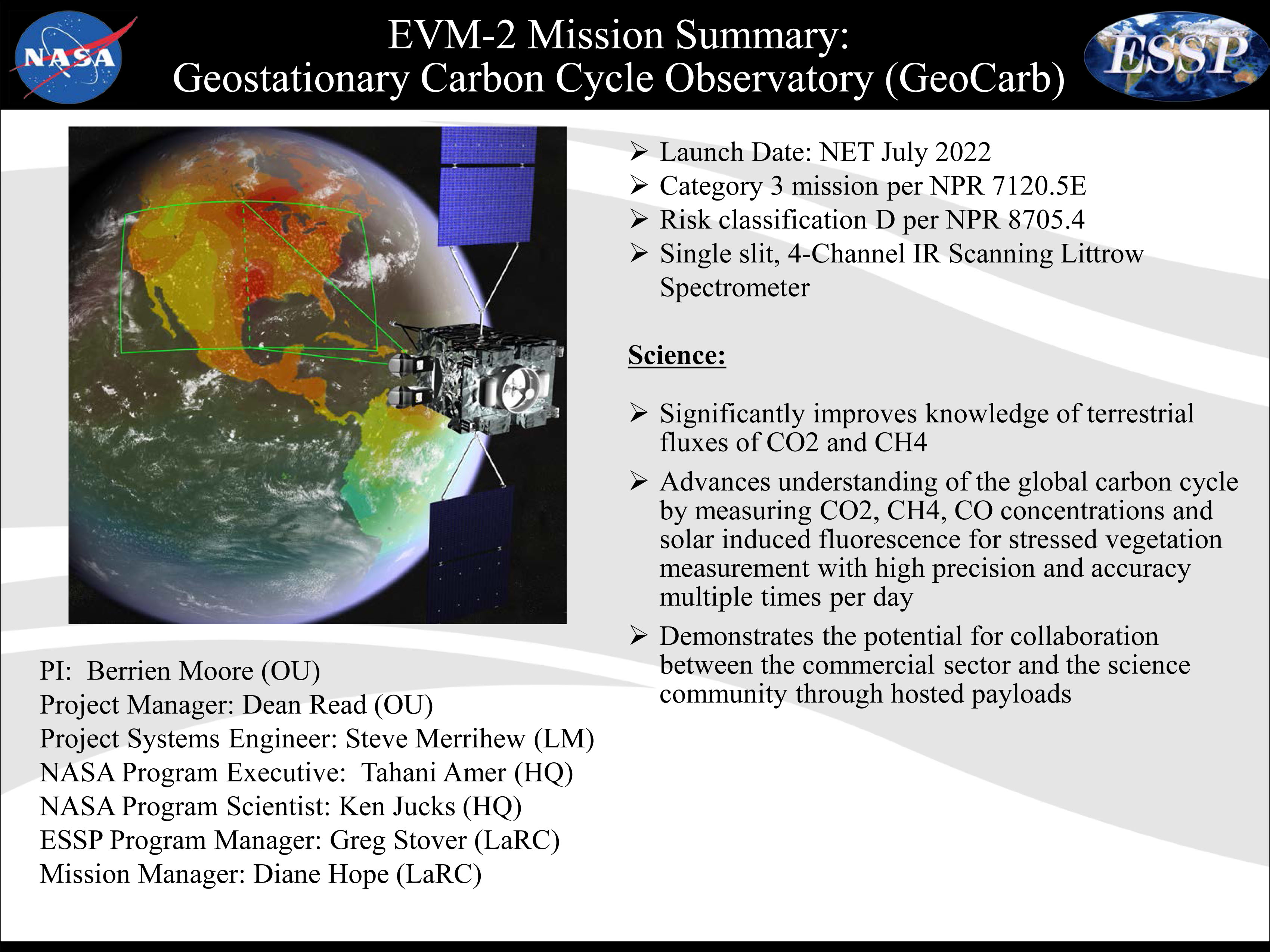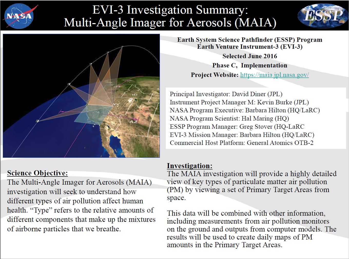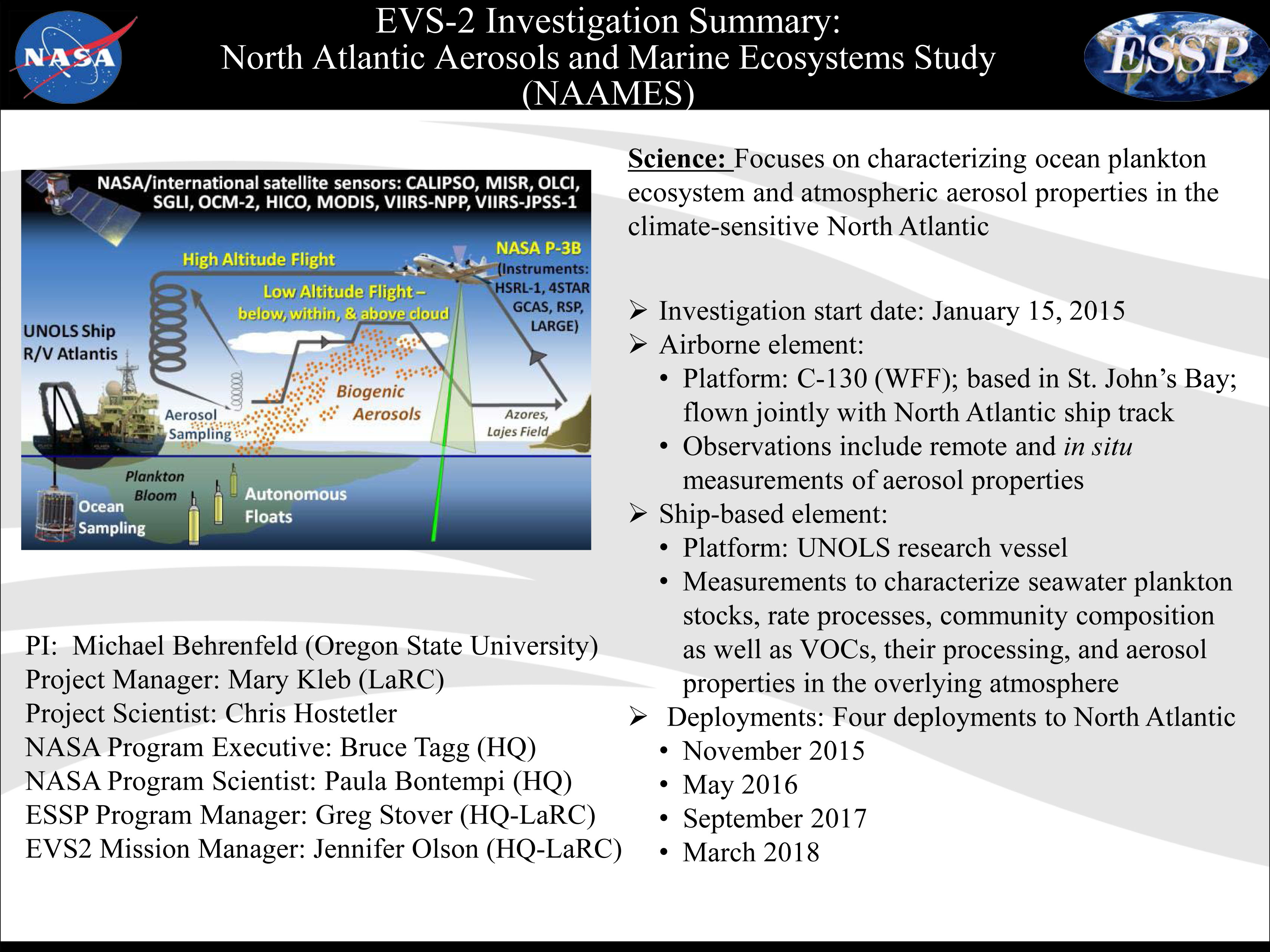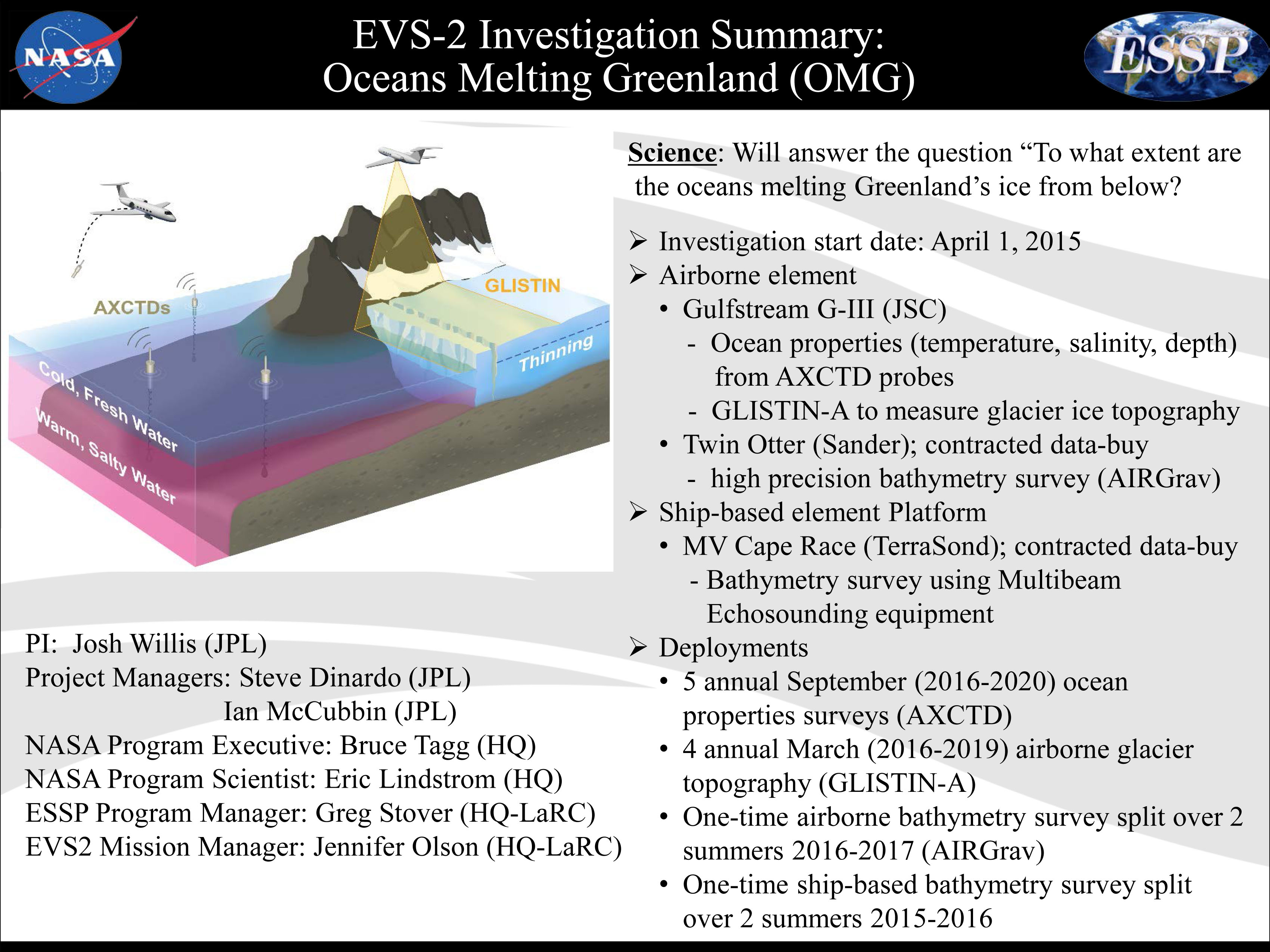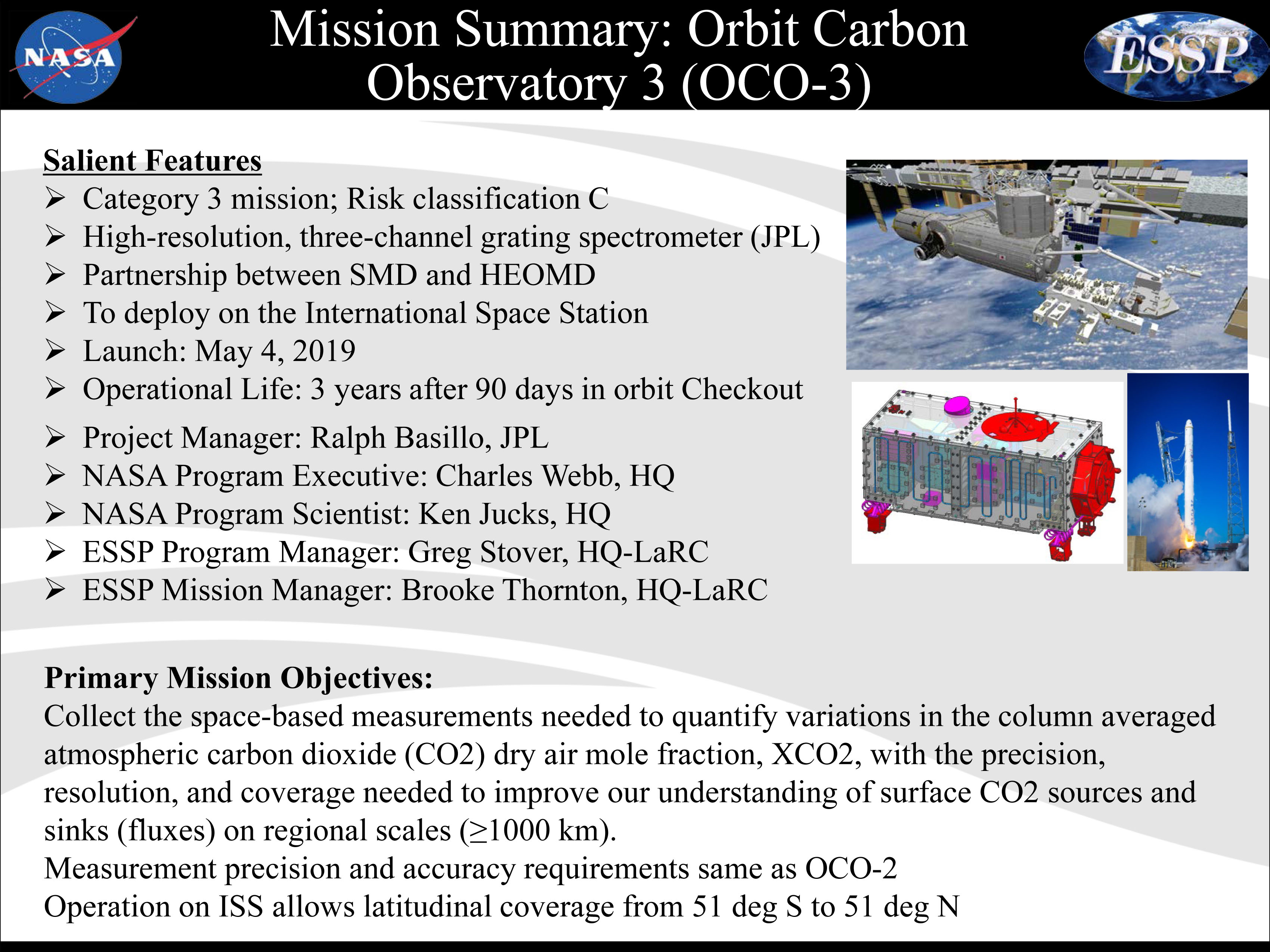
The 2020 Atlantic hurricane season was one of the most brutal on record, producing an unprecedented 30 named storms. What’s more, a record-tying 10 of those storms were characterized as rapidly intensifying — some throttling up by 100 miles per hour in under two days.
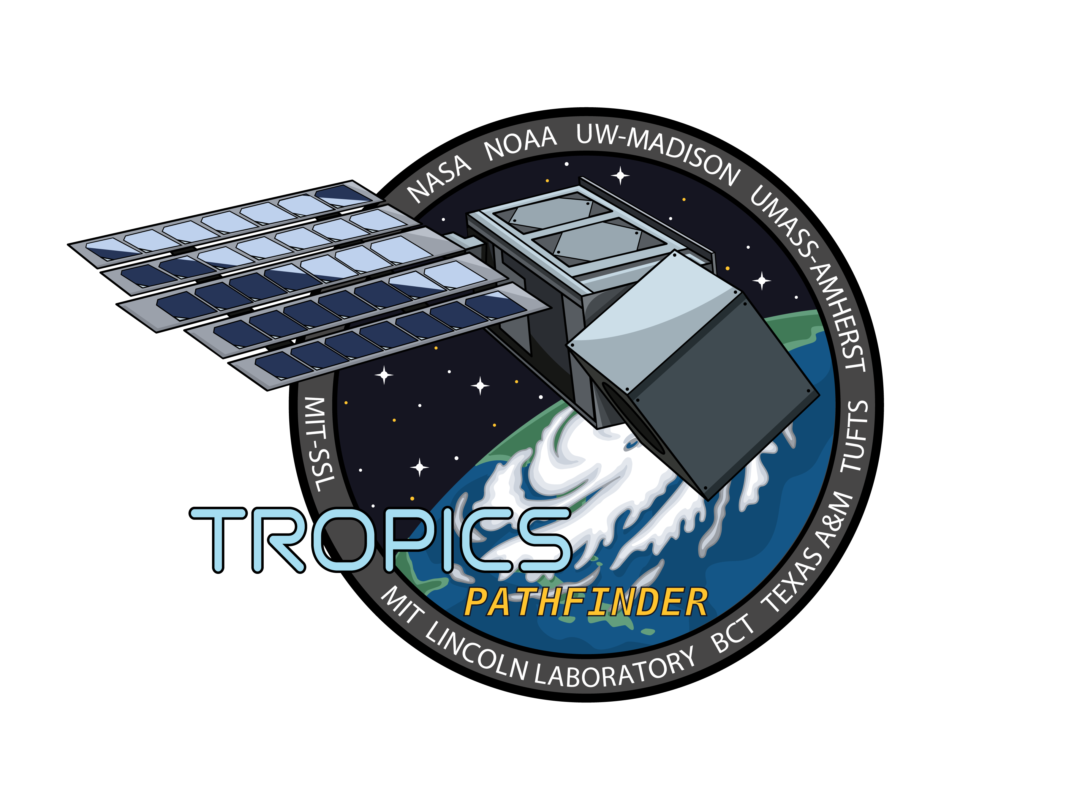
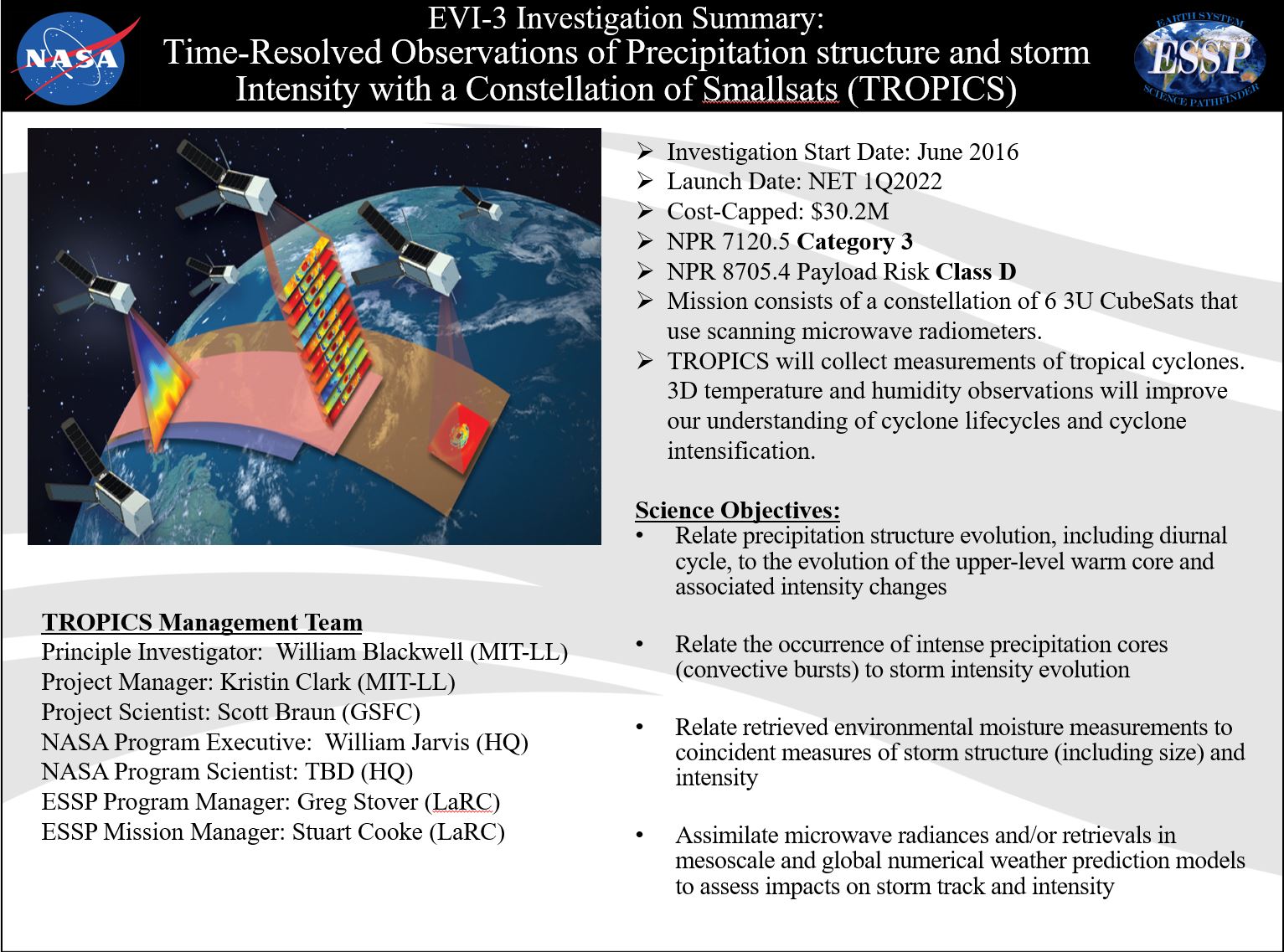
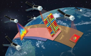
To bring more data to forecasters and have a more consistent watch over Earth’s tropical belt where these storms form, NASA has launched a test satellite, or pathfinder, ahead of a constellation of six weather satellites called TROPICS (Time-Resolved Observations of Precipitation structure and storm Intensity with a Constellation of Smallsats). Planned for launch in 2022, the TROPICS satellites will work together to provide near-hourly microwave observations of a storm’s precipitation, temperature, and humidity – a revisit time for these measurements not currently possible with other satellites.
“As a lifelong Floridian, I’ve seen firsthand the devastating impact that hurricanes can have on our communities. And as climate change is making hurricanes even stronger, it’s more important than ever that NASA and our partners invest in missions like TROPICS to better track and understand extreme weather,” said NASA Administrator Bill Nelson. “NASA’s innovation is strengthening data models that help scientists improve storm forecasting and understand the factors that feed these monster storms. TROPICS will help to do just that and we look forward to next year’s launch of the TROPICS satellite constellation.”
When launched, the TROPICS satellites will work together to provide near-hourly microwave observations of a storm’s precipitation, temperature, and humidity. The mission is expected to help scientists understand the factors driving tropical cyclone intensification and to improve forecasting models.Credits: NASA
“TROPICS is the beginning of a new era. This mission will be among the first to use a constellation of small satellites for these types of global, rapid-revisit views of tropical storms,” said Scott Braun, the TROPICS project scientist and a research meteorologist at NASA’s Goddard Space Flight Center in Greenbelt, Maryland.
Since tropical cyclones and hurricanes can change rapidly as they travel across the ocean, the increased observations from the TROPICS satellites will not only advance the science of understanding storm intensity, they also may improve intensity forecasts.
“The project holds great promise to boost NOAA’s steady improvements in weather and hurricane forecasts by feeding new environmental data into our world-class numerical weather prediction models,” said Frank Marks, director of the Hurricane Research Division of NOAA’s Atlantic Oceanographic and Meteorological Laboratory. After all six satellites are launched and positioned in 2022, “this new constellation will provide high frequency temperature and humidity soundings as we seek to learn how hurricanes interact with the surrounding temperature and moisture environment—key data that could improve hurricane intensity forecasts.”
A critical step to preparing for the constellation is the launch of a pathfinder satellite, a seventh identical copy of the TROPICS smallsats, that will enable full testing of the technology, communication systems, data processing, and data flow to application users in advance of the constellation’s launch. This will allow time for adjustments to the ground system and data products, helping ensure the success of the TROPICS mission.
“The TROPICS Pathfinder satellite is similar to a screening before the opening night of a big show,” said Nicholas Zorn, the Pathfinder program manager from MIT Lincoln Laboratory. “Its mission is a real-world, end-to-end test, from environmental verification through integration, launch, ground communications, commissioning, calibration, operations, and science data processing. Any areas for improvement identified along the way can be reinforced before the constellation launches.”
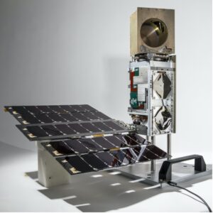
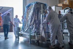
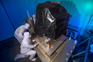
The TROPICS Pathfinder satellite, pictured above, was launched on June 30. The satellite body measures approximately 10 cm X 10 cm X 36 cm and is identical to the six additional satellites that will be launched in the constellation in 2022. The golden cube at the top is the microwave radiometer, which measures the precipitation, temperature, and humidity inside tropical storms.
Credits: Blue Canyon Technologies
MIT Lincoln Laboratory’s William Blackwell is the TROPICS principal investigator. Six years ago, he submitted TROPICS as a proposal to NASA’s Earth Venture Instrument competition series and was awarded funding. The Earth Venture Instrument program calls for innovative, science-driven, cost-effective missions to solve pressing issues related to Earth science.
Aboard each TROPICS small satellite is an instrument called a microwave radiometer, which detects temperature, moisture, and rainfall in the atmosphere. On current weather satellites, microwave radiometers are about the size of a washing machine. On TROPICS’ small satellites the radiometers are about the size of a coffee mug.
Microwave radiometers work by detecting the thermal radiation naturally emitted by oxygen and water vapor in the air. The TROPICS instrument measures these emissions via an antenna spinning at one end of the satellite. The antenna listens in at 12 microwave channels between 90 to 205 gigahertz, where the relevant emission signals are strongest. These channels capture signals at different heights throughout the lowest layer of the atmosphere, or troposphere, where most weather we experience occurs.
By flying the TROPICS radiometers at lower altitude and detecting fewer channels than their larger counterparts, in the channels they do carry, the radiometers deliver comparable performance.
Miniaturizing the microwave radiometer has been an incremental process over the last 10 years for Blackwell and his team, spurred by the invention of CubeSats, satellites the size of a loaf of bread that are often economical to launch. TROPICS builds on Blackwell and his team’s 2018 success in launching the first microwave radiometer on a CubeSat to collect atmospheric profiling data. The instrument aboard the TROPICS’ six satellites has been upgraded to provide improved sensitivity, resolution and reliability and will make more targeted and rapid weather observations.
“These storms affect a lot of people, and we expect that with the increased observations over a single storm from TROPICS, we will be able to improve forecasts, which translates to helping people get to safety sooner, protect property, and overall enhance the national economy,” Blackwell says, looking ahead to the full constellation launch next year. “It is amazing technology that we have proven out that allows us to maximize the science from the instrument’s size factor. To pull this off has taken contributions of so many people.”
The TROPICS science team includes researchers from MIT Lincoln Laboratory and MIT Department of Aeronautics and Astronautics; NASA’s Goddard Space Flight Center; NOAA Atlantic Oceanographic and Meteorological Laboratory; NOAA National Hurricane Center; NOAA National Environmental Satellite, Data, and Information Service; University of Miami; Colorado State University; Vanderbilt University; and University of Wisconsin. The University of Massachusetts Amherst, Texas A&M University and Tufts University contributed to the technology development. Maverick Space Systems provided integration services for the Pathfinder, which was launched from SpaceX’s Transporter 2 mission. Astra Space Inc. is providing launch services for the constellation. NASA’s Launch Services Program based at Kennedy Space Center procured and is managing the Tropics Pathfinder launch service.
By Kylie Foy
Massachusetts Institute of Technology, Lincoln Laboratory
NASA Media Contact: Ellen Gray, Earth Science News Team