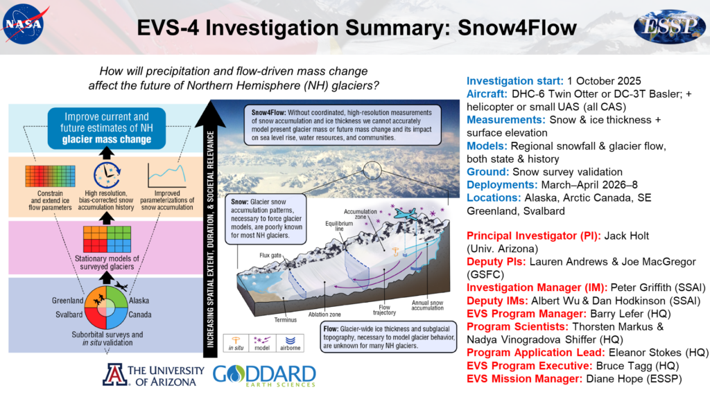
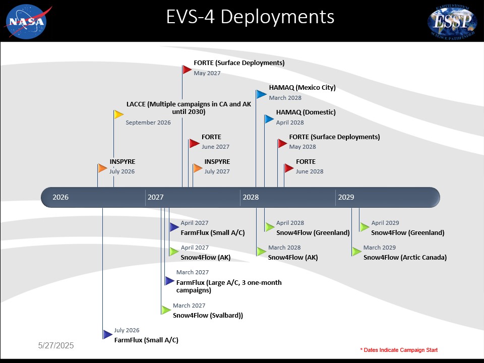
The Time Resolved Observations of Precipitation structure and storm Intensity with a Constellation of Smallsats (TROPICS)
Imagine if you could go inside a powerful cyclone? NASA’s TROPICS does and it aims to save lives on the journey
Tropical storms have been a source of some of the most devastating natural disasters, claiming countless lives and disrupting society. A rise in global temperatures is expected to ramp up storm frequency and magnitude . NASA’s Time Resolved Observations of Precipitation structure and storm Intensity with a Constellation of Smallsats (TROPICS) launched in 2020 and is focused on improving our ability to accurately predict storm strength, giving people more time to evacuate and save lives. How intense is a tropical storm going to get and what causes these cyclones (hurricanes and typhoons)? TROPICS is on a mission to find out with 3D temperature and humidity, cloud ice and precipitation tracking. This mission is critical because close to 60 million, nearly 1/5 of Americans, live along the East and Gulf coasts. We have seen Atlantic landfalling tropical cyclones (TCs) that can cause death and destruction like Katrina and recent estimates project a doubling of US economic losses from TCs every ten years!
TROPICS is going deep inside cyclones, so we can forecast storms better, improve disaster preparation and ultimately save lives.
-William Blackwell, Principal Investigator, TROPICS
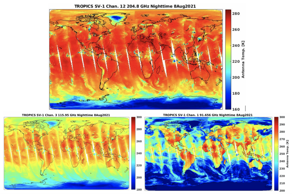
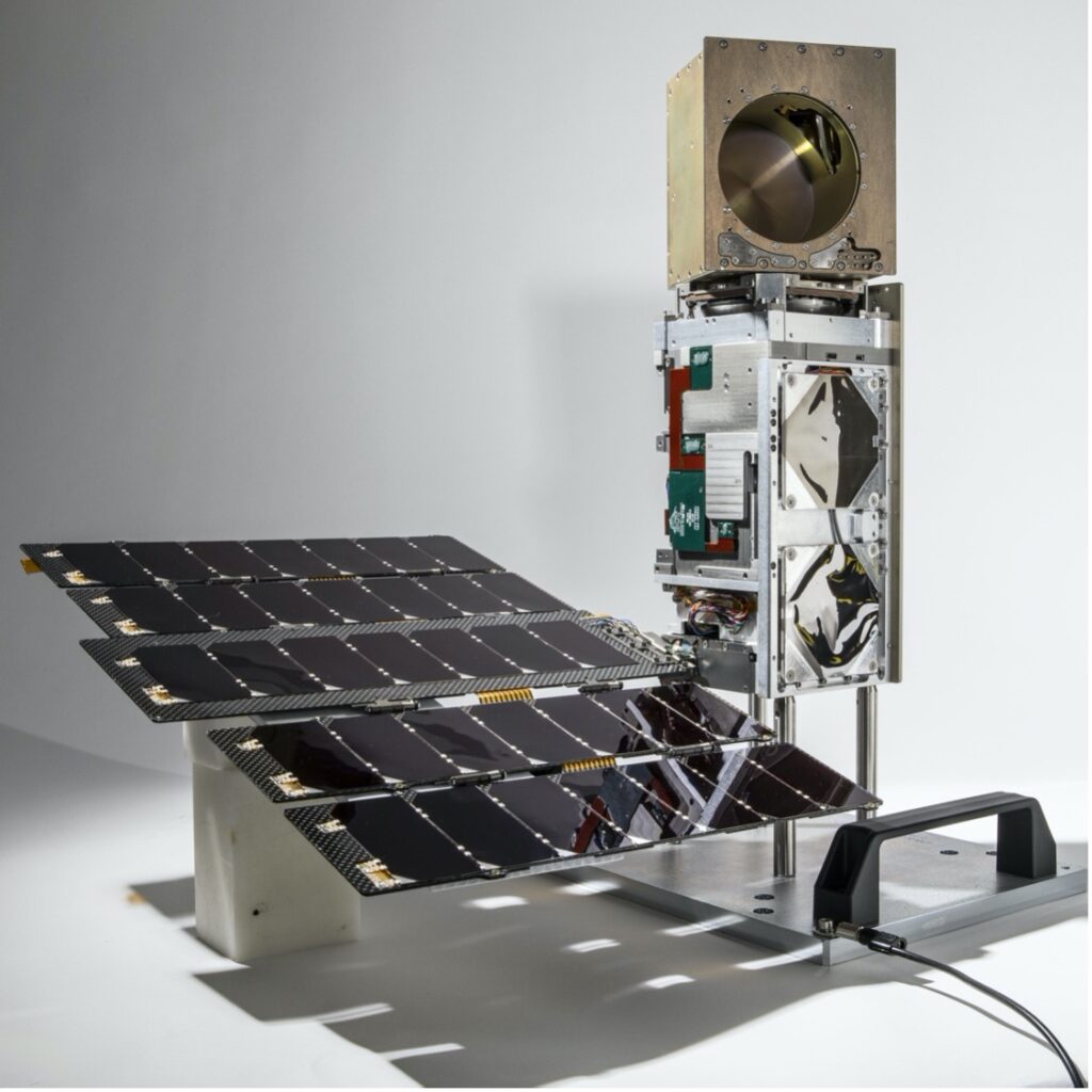
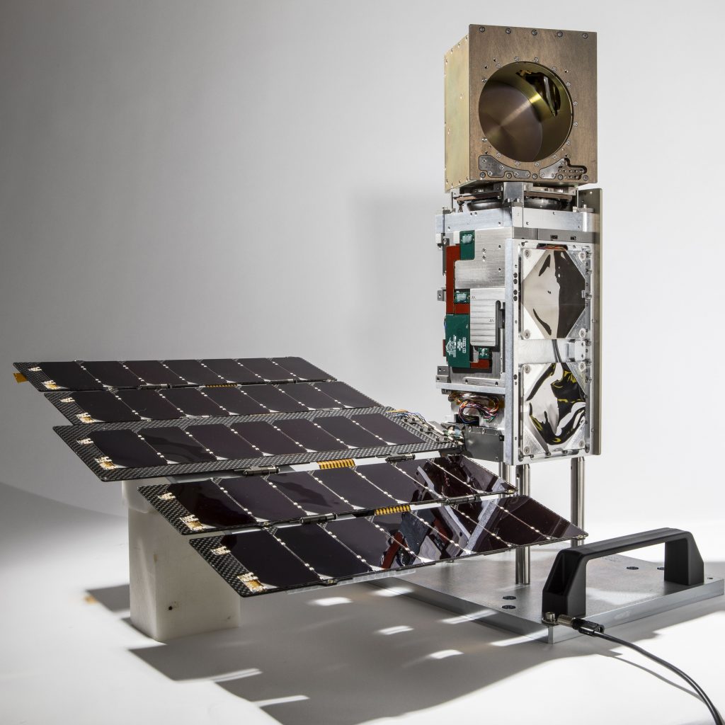
TROPICS provides high‐resolution, rapid‐updates on storm intensity and size (wind and precipitation structure). The science team measures precipitation and microclimates from 5 kilometers to several hundred kilometers across the sky. Better storm prediction over all ocean basins is provided by 12 small satellites called CubeSats. They fly aboard three low-Earth orbital planes. Each CubeSat hosts a high‐performance radiometer tracking water vapour absorption and precipitation‐sized ice particles. These instruments allow the team to actually go inside to the core of a cyclone, with high resolution from different angles. The power of this knowledge about how cyclones form, how they last and what makes some more intense than others, is leading to smarter storm predictions and better storm preparation by towns, cities, states and the people living in them. Come inside a cyclone and explore what we know so far.


 Cyclone Global Navigation Satellite System (CYGNSS)